A complete list of drones that have an EASA CE class identification label
There are six classes for drones in the EASA (European Aviation Safety Authority) open category: C0, C1, C2, C3, C4, C5 and C6. Where C0 to C4 are categories for new drones, C5 and C6 are for add-ons that are used to make drones compatible with the standard scenarios STS-01 and STS-02. Learn more in our article about the difference between the class labels. Here you can find a complete list of all drones that we could find that already possess a class identification label.
List of drones with C0 class identification label
Not yet marked: DJI Mavic Mini 3 Pro
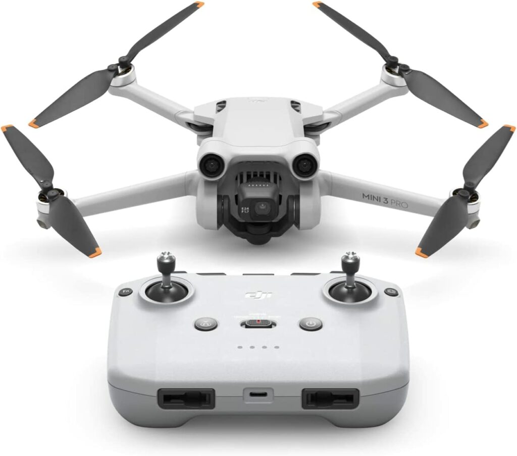
Although the Mavic Mini 3 Pro seems to be prepared to receive a C0 class label, no declaration of conformity has been issued yet. If you want to buy a small drone now, we propose to buy this one – although no assurances can be made.
The DJI Mini 3 Pro is a small, lightweight camera drone with a range of features that make it perfect for aerial photography and videography. With a weight of less than 249 grams, it’s easy to transport and use almost anywhere. It also comes with an extended flight time of up to 34 minutes, thanks to its ultra-lightweight Intelligent Flight Battery. The drone has excellent image and video quality, with 4K HDR video and 48MP RAW photos at transmission distances of up to 12 km.
List of drones with C1 class identification label
DJI Mavic 3 & Classic

The DJI Mavic 3 (including the Classic, but not the Pro versions) has a C1 class identification label and declares compliance with all applicable C1 requirements. If you already have one, but without the label, you can order a label from DJI and retroactively apply it to your drone.
DJI Mavic 3 Cine
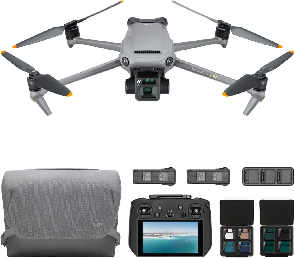
The DJI Mavic 3 Cine has a C1 class identification label, awarded in conjunction with TÜV Rheinland. If you already have one, but without the label, you can order a label from DJI and retroactively apply it to your drone.
List of drones with C2 class identification label
AgEagle eBee X
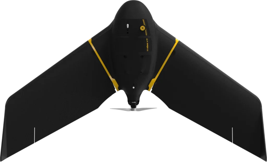
The SenseFly / AgEagle eBee X has a C2 class identification label, its compliance was tested together with NavCert.
The eBee X is a versatile and advanced fixed-wing drone suitable for surveying and mapping needs. With a lightweight and durable design, it can operate in harsh conditions and fly for up to 90 minutes, covering up to 500 ha (1,235 A) while flying at 400 ft. Its eMotion flight planning software is packed with advanced features to make flying and data collection easy and efficient.
AgEagle eBee Geo

The SenseFly / AgEagle eBee Geo has a C2 class identification label, its compliance was tested together with NavCert.
The eBee Geo is an affordable fixed-wing mapping drone that is ideal for surveying and mapping small to large areas. It is designed to operate in harsh conditions and comes with the S.O.D.A. sensor, which captures sharp aerial images for producing vivid orthomosaics and elevation models. With up to 45 minutes of flight time, eBee Geo can cover up to 160 hectares (395 acres) at 120m (400ft) with a 2.5cm absolute accuracy. It is safe and easy to use, making it perfect for surveyors, civil engineers, and GIS professionals worldwide for a range of applications including surveying, topographic mapping, urban planning, water management, and forestry, among others.
AgEagle eBee Ag
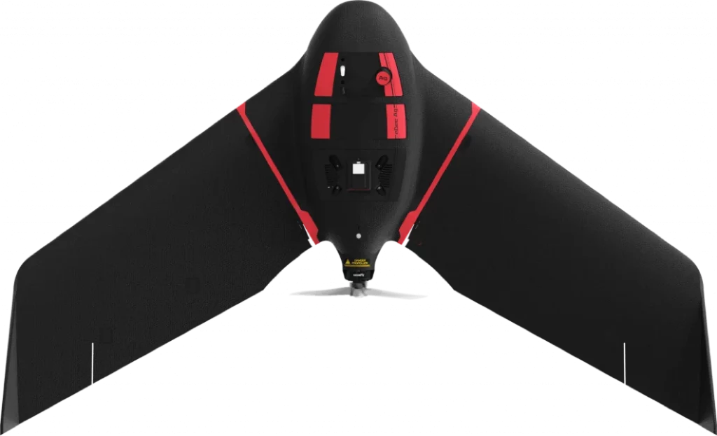
The SenseFly / AgEagle eBee Ag has a C2 class identification label, its compliance was tested together with NavCert.
The eBee Ag is a fixed-wing drone equipped with the Duet M multispectral/RGB camera, designed to help farmers and agronomists map and monitor crops quickly and easily. Its automated flight and vast coverage provide accurate and timely plant health insights, enabling better decision-making to improve crop yields, save on inputs, allocate resources, and achieve greater profit potential. The eBee Ag is lightweight, durable, and safe to use, and can achieve up to 55 minutes of flight time.
The Duet M camera combines multispectral and RGB capabilities, allowing users to create geo-accurate multispectral maps and digital surface models quickly and easily. It can be used for crop planning, planting, plant health monitoring, crop scouting, water and soil management, pest, diseases and weed tracking, prescription maps, fertilizer and input efficacy, yield monitoring and forecasting, and crop insurance assessments.
DJI Mavic 3 Pro
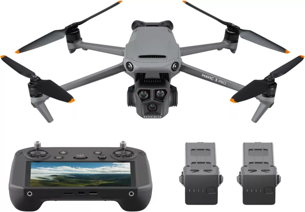
The DJI Mavic 3 Pro has a C2 class identification label. If you need a C1 drone, look at the Classic versions of the Mavic 3.
DJI Matrice M30 Series

The DJI Matrice M30 Series has a C2 class identification label.
List of drones with C3 class identification label
Quantum Systems Trinity F90+

The Quantum Systems Trinity F90+ has a C3 class identification label, its compliance was tested together with ALTER.
The Trinity F90+ drone is a versatile tool suitable for a variety of applications. Its extended flight time and easy-to-use mission planning software make it ideal for mapping large areas quickly and accurately. Additionally, the choice of integrated cameras, including RGB, oblique, multispectral, and even LiDAR, make it suitable for a wide range of mapping applications, including agriculture, forestry, mining, and surveying. The drone’s portability and rugged design also make it ideal for use in remote or challenging environments, such as disaster response or environmental monitoring.
DJI Matrice M350RTK
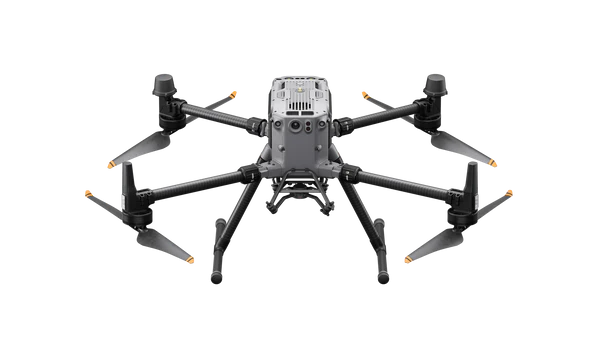
The DJI Matrice M350RTK has a C3 class identification label.
List of drones with C4 class identification label
No drones with the C4 class label are currently on the market.
List of drones with C5 class identification label
No drones or add-ons with the C5 class label are currently on the market.
List of drones with C6 class identification label
Delair UX11

The Delair UX11 has a C6 class identification label, no information on the Notified Body that issued the label is available right now. The C6 identification label, which pre-existing customers of the UX11 can apply through a retrofit kit, enables the drone to be used in the EASA Standard Scenario STS-02 for Beyond Visual Line of Sight (BVLOS) operations at a maximum distance of 2km from the pilot, using airspace observers and a controlled ground area.
The UX11 is a fixed-wing drone designed for professional mapping projects. It can cover a large area in a single flight while maintaining high resolution and accuracy. The UX11 comes equipped with a high-end industrial-grade camera, a high-quality GNSS receiver, and professional-grade software tools, such as the Delair Flight Deck for mission planning and the Delair After Flight for data processing. The camera in the UX11 was specifically designed for mapping projects in a lightweight drone.
List of drones with unknown class level
Nokia Drone Networks
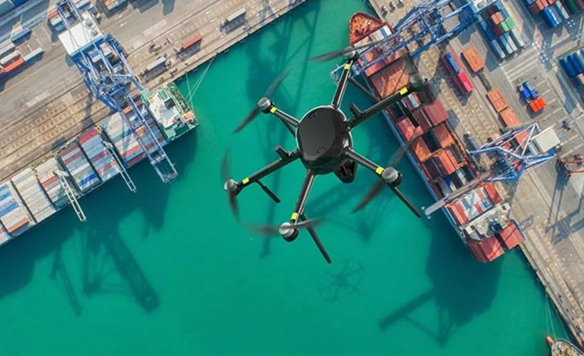
The Nokia Drone Networks drone-in-a-box solution is catering to the needs of various organizations such as public safety agencies, smart cities, and industries like construction and energy. The solution includes Nokia drones, a docking station, dual gimbal camera, and edge data processing using Nokia MX Industrial Edge. It connects over 4G/LTE and 5G networks, enhancing situational awareness for professionals and first responders.
The turnkey drone solution is said by Nokia, together with an unnamed Notified Body, to be CE compliant, however no information on which class identification label (C0-C4) the drone has is available at the moment.
